This activity has been marked as cancelled.
Clyde Mountain & Upper Musgrave Creek
Thu 14th Nov 2019
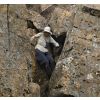
Date changed to Thursday, to avoid fire danger forecast for Tuesday. An off-track circuit north of the Kings Highway. We start on the 'Clyde Mountain Walking Track', which is some help although it disappears within 200 metres, then to the summit of Clyde Mountain (tree filtered views). From there north on ridges to some beautiful rainforest with big old tree ferns, next the pretty top section of Musgrave Creek, and the summit of Sugarloaf (more views), ending with a descent through the rainforest above Pooh Corner. Yes, quite a bit of scrub, including thigh-deep ferns laced with prickly vines. But also some open and semi-open forest. The descent of Musgrave Creek will involve steep, loose slopes, where you may need to hold on to vegetation for balance - maybe you'll get to swing on a few monkey vines. Requires previous off-track experience.
Additional Information
Length
Medium
Terrain
Rough
Conditions
Partly Exploratory
Distance
7 km in about 7 hours of actual walking
Ascent
Main ascent 450 vertical metres, several other minor climbs
Descent
Main descent 350 vertical metres, several other minor descents
Map Name
Monga 1:25,000
Terrain Information
6 km off-track at just under 1 kph through scrub, rainforest, open and semi-open eucalypt forest. Some steep, loose slopes. 1 km of walking beside the Kings Highway to return to cars.
Transport Information
$76 per car. A 1 hour 10 minute drive from Queanbeyan, all sealed road.
Canberra Bushwalking Club legacy activity structure - from imported data. Do not use it for new activities.
Date and Time
Activity Owner
linda-groom01
Linda Groom