
Stoney Creek Nature Reserve
Sun 26th Jul 2026
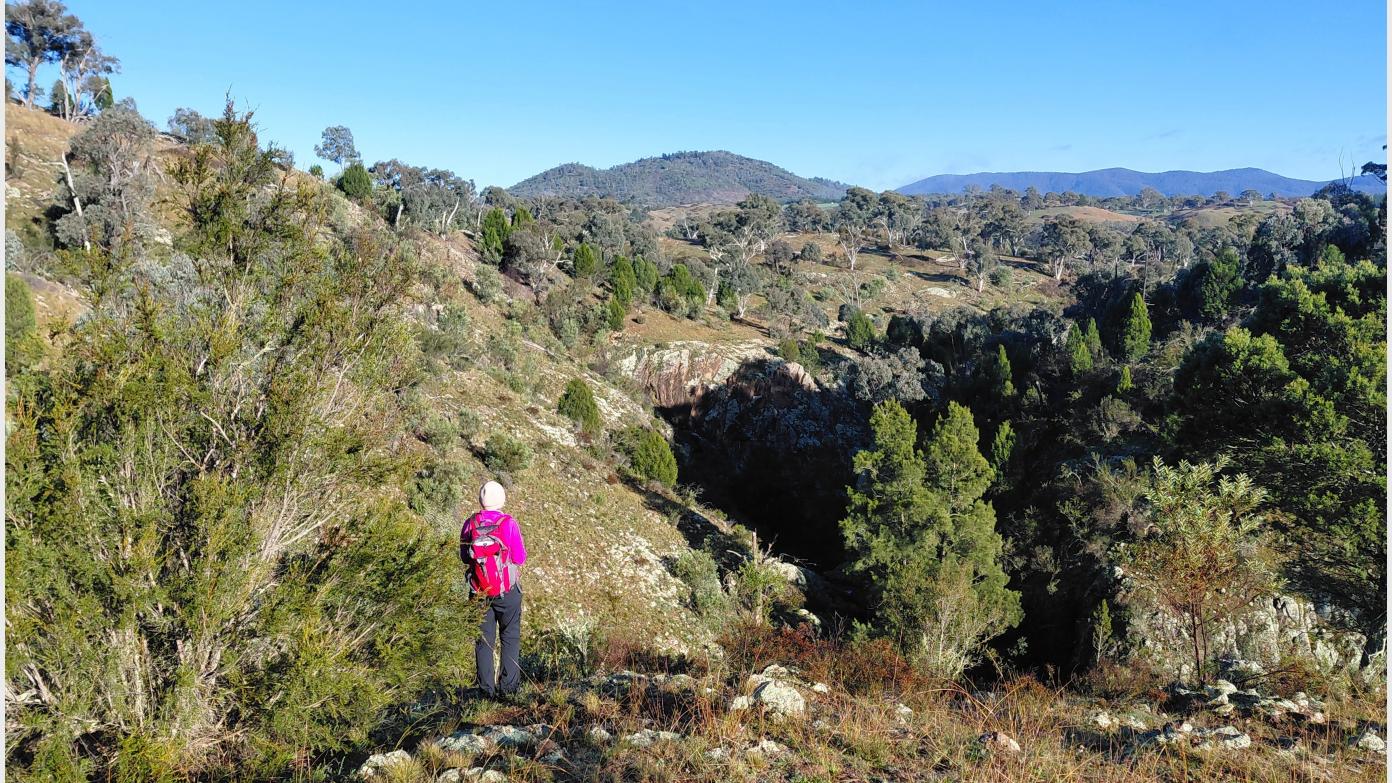
This hike explores the grassy woodlands and rugged terrain of the Stoney Creek Nature Reserve, part of the Murrumbidgee River Corridor. From the trailhead, we follow a management trail southwest into the reserve before turning northwest to cross Stoney Creek. Beyond the creek, we traverse a series of knolls that provide expansive views across the Murrumbidgee River and the surrounding landscape. We then descend a steep spur to explore the open grassy woodlands below before following the true left bank of Stoney Creek to the south west across a series of gullies and spurs followed by a steep climb to the south leading to a pair of scenic vantage points overlooking the Murrumbidgee River. The return journey passes through open grassy woodlands before re-joining a management trail back to the starting point. While the route incorporates sections of defined trail, most of the walk is off-track across undulating terrain with steep slopes and rocky or grassy surfaces that may be slippery or unstable underfoot. Walking pole(s) might be useful and gaiters and/or long pants a must to protect legs from injury. With a linear distance of approx.12.0km and an adjustment for elevation gain of 420m makes this hike equivalent to an on-track walk of 16.2km. The hike is likely to take 5.5hrs to complete at a steady pace and best suited for walkers with a moderate-to-good level of fitness, who are comfortable off track and have completed successfully at least one hike of 12km in the past month. Nature Connection: This walk intentionally balances social walking with short, clearly defined periods of quiet, attentive mindful walking and a brief sit spot to foster a more immersive experience of and a deeper engagement with the landscape. Participants should be comfortable with occasional silence and willing to engage respectfully with this rhythm of walking. Conversation is warmly welcomed at all other times.
Additional Information
Booking deadline
Fri 24th Jul 2026 02:00pm
Length
Medium
Terrain
Medium
Conditions
Partly Exploratory
Distance (km or hrs)
12km, 5hrs
Ascent
420
Descent
420
Terrain information
Defined trails, off-track across undulating terrain with steep slopes and rocky or grassy surfaces that may be slippery or unstable underfoot
Transport information
Participants to make own way to meeting point prior to a car pool to trail head. Meeting time and place to be advised.
A walk or similar activity with a duration of a day or part day. No overnight gear required.
Date and Time
Activity Owner
SalihOzgul
Salih Ozgul
Activity Location
Have a question for the activity organiser?
Type your message and we’ll pass it straight to the organiser. They’ll get back to you directly, so response times may vary — thanks for your patience while they reply!