Byangee Walls day hike with car camp the night before
Sat 23rd May 2026
Sign in or Create new account
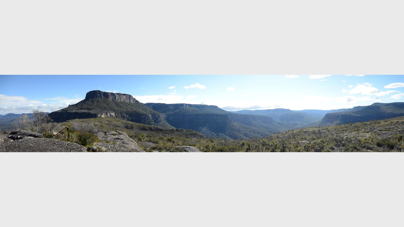
The objective for this day hike is to summit the Byangee Walls and enjoy the sweeping views up and down the Clyde River valley and across to the Castle and Pigeon House Mountain.
The hike will begin with a stream crossing of the Yadboro River at the Long Gully camp ground, then up a steep fire trail to the gap between The Castle and the the Byangee Walls, followed by a near vertical climb up a series of narrow rock fissures, to the top. Return by retracing the route.
The length of the walk is quite short (around 15km round trip), but the elevation gain is significant at 500m and the last section of climb will be strenuous, at times using a rope as a hand line, (although hikers with climbing experience should be able to manage this without rope.) The combination of challenges means this walk is graded as difficult but rewarding!
Progress will be slow and there will be lots of opportunities to pause and enjoy the features, which means it will be a long day requiring an early start. Travel from Canberra (3.5 hours) will be undertaken the previous day to an overnight camp at the Long Gully camp ground, aiming to break camp and start the hike at 8:00am on the day of the hike. Return to the camp ground by 4:00pm.
Gear required is minimal
- A day pack with your usual day rations and personal items
- Water, a full days requirement, allowing for perspiration losses over steep terrain (minimum 3 litres/hiker)
- Rain and sun protection
- Hand held torch - there is a small grotto to inspect along the way
- River crossing footwear. The river bed is comprised of loose river stones that are hard on feet. Sandals or some other footwear to protect your feet will be helpful
This trip is dependent on weather conditions, but cool temperatures and light showers are expected and acceptable. Heavier rain may make the trail too slippery or the river crossing unsafe and mist would wipe out the views.
Additional Information
Booking deadline
Fri 15th May 2026
Length
Medium
Terrain
Rough
Distance (km or hrs)
8 hours
Ascent
500
Descent
500
Map name
Corang 1:25,000 Topographic
Terrain information
Steep, fire trail, rough track and rock climbing and scrambling
Transport information
It would be good to avoid driving in the dark to the camp ground on Saturday, so the plan is to leave Canberra at around 2:00pm, pick up location TBC. Car pooling - please advise if you can drive and share your vehicle.
A walk or similar activity with a duration of a day or part day. No overnight gear required.
Date and Time
Activity Owner

To-the-Max
Activity Location
Have a question for the activity organiser?
Type your message and we’ll pass it straight to the organiser. They’ll get back to you directly, so response times may vary — thanks for your patience while they reply!