Mulligans, Sun Moth Hill, Centenary Trail - E-M Wednesday Walk #1 …. No Need to Book
Wed 08th Apr 2026
Bookings available to active members only.
Wednesday Walk - No need to register onto this walk
Please contact the leader if this is your first walk with the club.
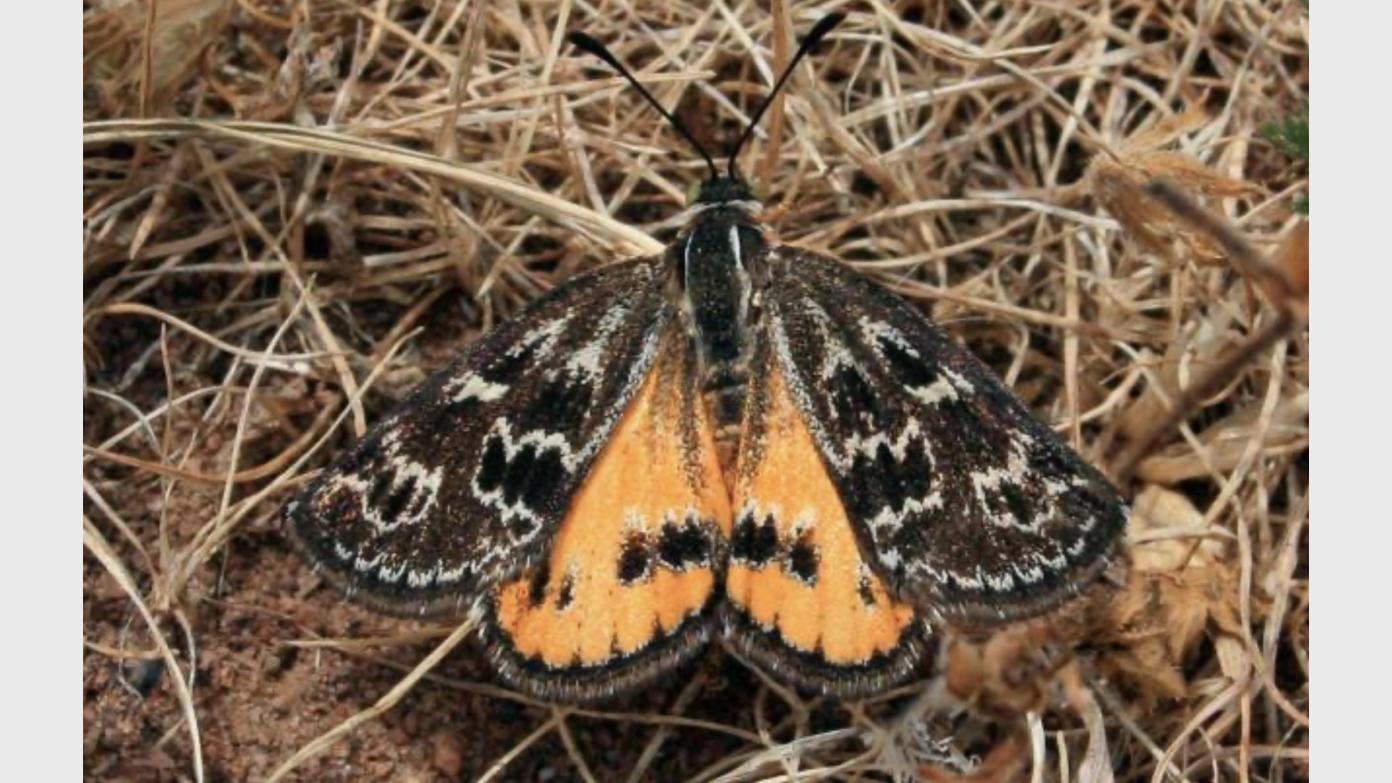
Starting from Mulligans Flat Road on the edge of Bonner and Forde, we’ll head over to Sun Moth Hill to learn a bit about the Golden Sun Moth which is a vulnerable species in our region and is a key indicator of the health of our native temperate grasslands. From here we’ll make our way to the Northern Border Campsite via the Centenary Trail for morning tea and continue further along the border trail with NSW for several kilometres until we leave this trail and join several connected firetrials to visit some hills above the suburbs of Jacka and Bonner. A koala was recently spotted in the hills close to Jacka, so we’ll keep our eyes open…we might be lucky enough to see one! Our way back to the start of our walk will bring us closer to the suburban fringe on a mix of firetrails, single track and footpaths.
Maps: Hall, 1:25,000
Distance: 13kms (We should finish before 2pm)
Ascent/Descent: 490 mtrs
Track Description: Mostly on firetrails and well formed single track. Hilly, but well graded trails, some short steep sections with loose rocks. Some short but easy sections of off track. Bring walking poles if you wish.
Meeting Time: 8.15 am for an 8.30 am departure
Meeting Place: Car park is located on Mulligans Flat Road. Locate the junction of Henry Williams Street and Mulligans Flat Road (which is a roundabout), the car parking is less than 100 metres from here - i.e: east, towards the direction of Sutton.
Transport: Meet at the start. No car pooling.
Weather for next Wednesday: 13C to 26C. Partly cloudy, very little chance of any rain.
What to Bring: Day-pack, sunscreen, hat, 2 litres of water, morning tea and lunch.
Those doing their first Wednesday walk and those who are not members of the BBC, NPA or CBC must contact the leader beforehand.
Additional Information
Length
Medium
Terrain
Medium
Distance (km or hrs)
13kms
Ascent
490 mtrs
Descent
490 mtrs
Map name
Hall 1:25000
Terrain information
Mainly formed tracks and fire trails, some loose rocks, steps, a short amount of off track walking, footpaths.
Transport information
Meet at car parking location. No car pooling.
A walk or similar activity with a duration of a day or part day. No overnight gear required.
Date and Time
Activity Owner

DaveAbela
David Abela
Activity Location
Have a question for the activity organiser?
Type your message and we’ll pass it straight to the organiser. They’ll get back to you directly, so response times may vary — thanks for your patience while they reply!