Cuumbeun Nature Reserve Southern Section
Sun 19th Apr 2026
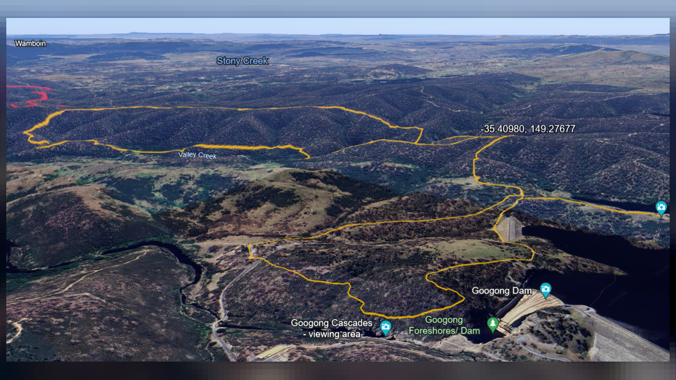
We follow a fire trail to the SE to meet up with the Bradleys Creek Walk. After a short while we go off-trail to enter the Cuumbean NR proper. We descend a spur to the NW to Valley Creek and then follow the contours of Valley Creek NW crossing varies gullies and creeks and ascending and descending several spurs and knolls before a steep climb NE to join the Queanbeyan River Trail. We have a brief respite from off-trail walking as we follow this trail to the SE prior to descending towards Valley Creek via various ridges, spurs, and gullies. One last steep ascent to the SW, a ridge line and descend to the W to connect once again to Bradleys Creek Walk. We have a side trip to take in the Googong Dam and then join the Black Wallaby Loop Track to return to our start. The walk will be predominately off-trail, criss-crossing the undulating landscape with some steep sections and rocky/grassy slopes and creek lines that are slippery and/or unstable under foot with varying thickness of vegetation from open woody grasslands to moderately thick scrub. Walking pole(s) might be useful at times and gaiters and/or long pants a must to protect legs. The linear distance of 12.5km with an adjustment for elevation gain of 600m makes this equivalent to a 18.5km track walk. Given the nature of the terrain (surface, vegetation, steepness) and the length/elevation gain/loss the hike is likely take approximately 5.5hrs to complete and is best suited for walkers with a moderate level of fitness, who are comfortable walking off track and have completed successfully at least one 12-14km hike in the past month. Nature Connection: This walk intentionally balances social interaction with brief, guided periods of quiet, attentive walking and a short 'sit spot.' These moments are designed to support a deeper engagement with the landscape. Conversation is warmly welcomed at all other times.
Additional Information
Booking deadline
Fri 17th Apr 2026 02:00pm
Length
Medium
Terrain
Medium
Conditions
Partly Exploratory
Distance (km or hrs)
approx. 12.5km
Ascent
approx. 600m
Descent
approx. 600m
Map name
8727-2S HOSKINSTOWN
Terrain information
Fire trails. Single trails. Footpads. Off-trail. Undulating landscape with some steep to very steep sections and rocky/grassy slopes and creeks that are slippery and/or unstable under foot with varying thickness of vegetation from open woody grasslands to moderately thick scrub.
Transport information
Participants to make their own way to the meeting place/start point. Meeting place to be advised.
A walk or similar activity with a duration of a day or part day. No overnight gear required.
Date and Time
Activity Owner
SalihOzgul
Salih Ozgul