Thredbo to Mt Hotham on the AAWT - "Le 2R de Hût"
Sat 24th Oct 2026
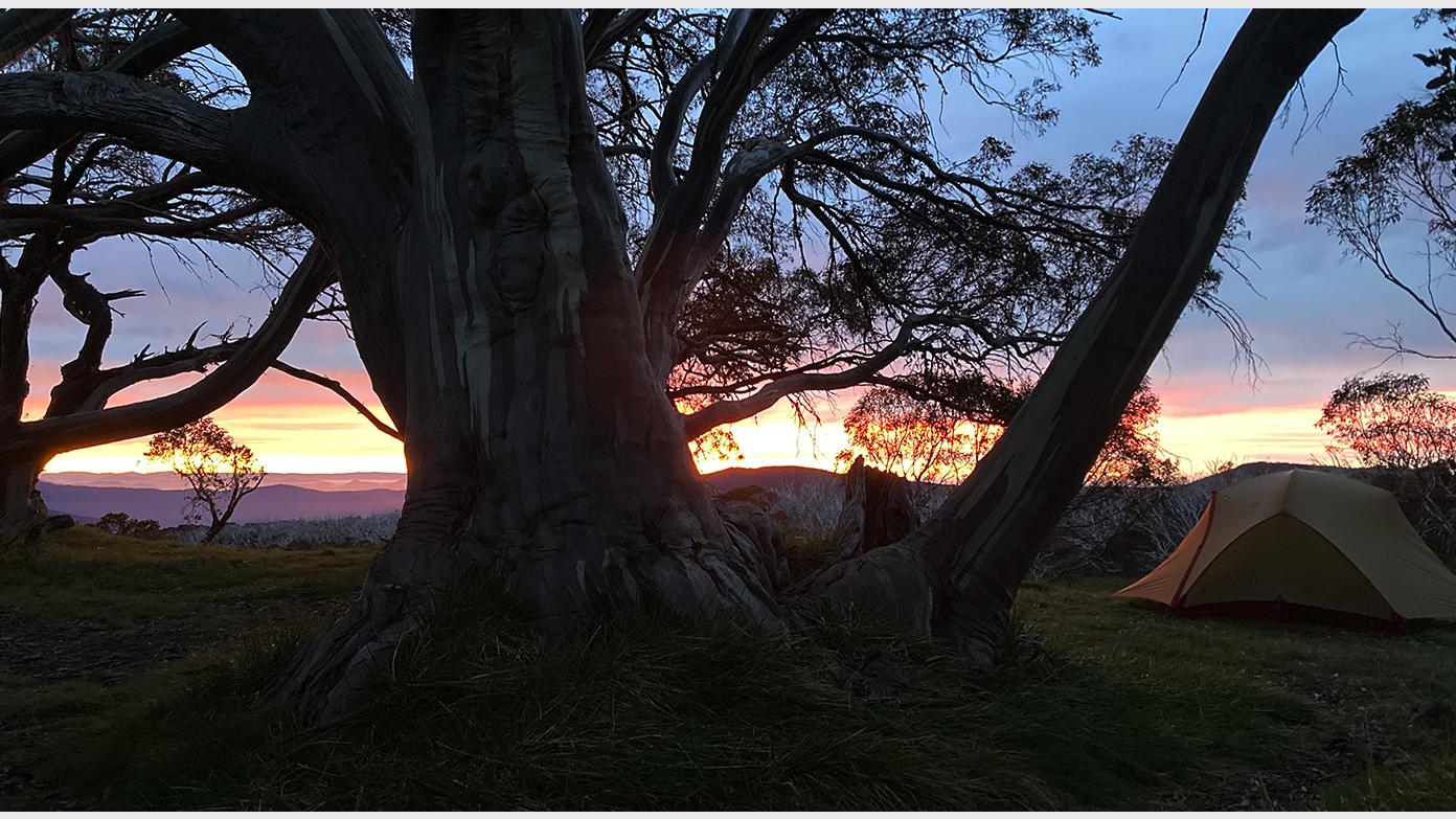
Following on from last December’s Thredbo > Tharwa “Le Tour De Hut” walk, this will be a 13 day, 255km walk along the middle third of the AAWT. Walking south from Thredbo, we’ll encounter snow gum forests and winding rivers, historic huts, cross the mighty Murray by stepping over it, follow high ridge lines, summit Mount Bogong (weather permitting) and cross the exposed Bogong High Plains.
Two spare days allow a full day at Hotham after, and one for bad weather if needed.
Participants will need experience of multi-day pack hikes and a good understanding of what sort of distances and elevations they are capable of walking day after day. While I’ve tried to keep the daily distances to a manageable level, the compound effect of walking with a pack for twelve days is not to be underestimated. Once begun, there aren’t a lot of opportunities to get off the track. Occasional fantastic views guaranteed. Preference will be given to those I’ve walked with and whose capacity I’m familiar with, and those who completed section one.
Please indicate if willing to drive.
Day 0: Travel day.
Day 1: Start from Dead Horse Gap. Walk to Cascade Hut: 10km +290m -360m
Day 2: To Tin Mine hut via Tin Mine Falls lookout (optional): 18km +280m -500m
Day 3: To Cowombat Flat via Pilot summit (optional): 22km +660m -770m)
Day 4: To Limestone Ck: 22km +450m -690m
Day 5: To Buckwong Ck: 16km, +700m -650m
Day 6: To Johnnie's Top 25km +1000 -500
Day 7: To Taylor's Crossing 25km +400 -1400
Day 8: To Sunnyside 21km +1200 -500
Day 9: To Mt Wills Hut: 7km +500m -100m
Day 10: To Cleve Cole Hut: 19km +800m -800m
Day 11: To Ropers Hut via Mt Bogong: 23km +750m -800m
Day 12: To Cope Hut: 19km +350m -350m
Day 13: To Mt Hotham: 25km +700m -700m
Day 14: Optional day trip to Mt Feathertop
Additional Information
Booking deadline
Sat 03rd Oct 2026 12:00pm
Length
Long
Terrain
Medium
Conditions
Partly Exploratory
Distance (km or hrs)
See itinerary
Ascent
See itinerary
Map name
John Chapman - Australian Alps Walking Track
Terrain information
A variety of tracks and trails, ranging from fire trail to well maintained track to short unmaintained sections indistinguishable from off-track walking. Some days with up to 1000m of elevation gain. Some snow and overnight temperatures below freezing are distinctly possible.
Transport information
Option One: If we have three drivers; drop three walkers to stay the night in Thredbo, do a car shuffle to Hotham (the three drivers staying the night there or camping) then return and leave one car in Thredbo. $480/car, $240 each if six walkers. Option two: If two drivers, we all drive to Mt Hotham, stay the night, then take transport to Thredbo. $480/car. SnowDog Transport to Thredbo: $1150 for group. Total: approx. $350 each if six walkers. Subject to change with petrol prices.
Travelling date
Sat 24th Oct 2026 07:00am
Accommodation information
We will likely stay one night in a lodge at Mt Hotham or Thredbo at the start, and two nights at Mt Hotham after the walk. Probably about $150-$250 total each. During the walk we will camp in tents.
A multi day backpacking or base-camping activity.
Date and Time
Activity Owner
Chris-Day
Chris Day
Activity Location
Have a question for the activity organiser?
Type your message and we’ll pass it straight to the organiser. They’ll get back to you directly, so response times may vary — thanks for your patience while they reply!