Mt Taylor
Sat 28th Feb 2026
Sign in or Create new account
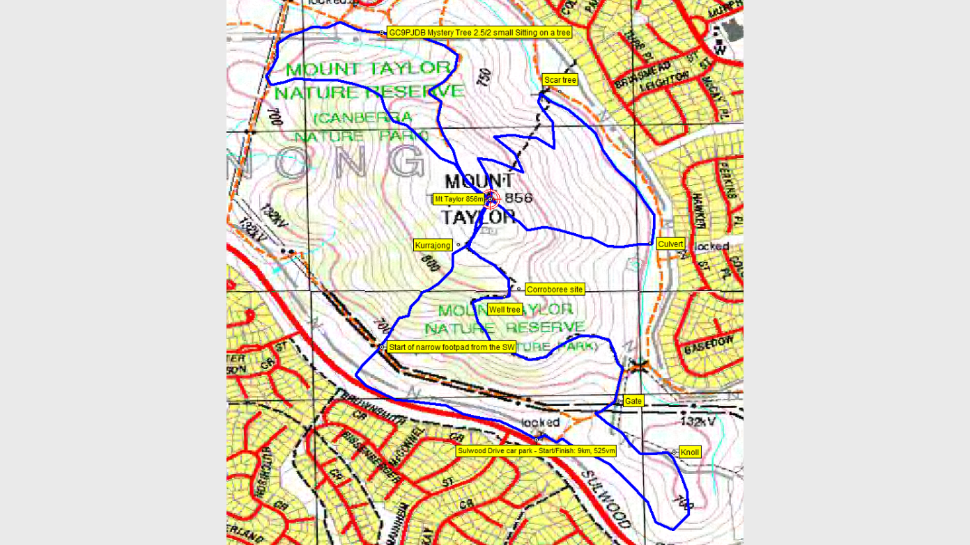
We’ll go up and down 3 times by different routes. They’re all steep, a couple rocky. For extra variety, I’ll throw in an aboriginal well tree, a scar tree and a geocache. We’ll come back via the rocky knoll to the south-east of Mt Taylor. Around 10km and 525vm. Poles could be useful. Elder’s pace 😂, particularly uphill. Early start, home for lunch.
Additional Information
Booking deadline
Fri 27th Feb 2026 10:00am
Length
Medium
Terrain
Medium
Distance (km or hrs)
10km
Ascent
525vm
Map name
Canberra and Tuggeranong 1:25000 topos
Terrain information
Fire trails, steep and rocky footpads, off track through open going
Transport information
Drive yourself to meet ready to walk at 7am in the large Sulwood Drive car park, near the Mannheim St traffic lights
A walk or similar activity with a duration of a day or part day. No overnight gear required.
Date and Time
Activity Owner

John-Evans
John Evans
Activity Location
Have a question for the activity organiser?
Type your message and we’ll pass it straight to the organiser. They’ll get back to you directly, so response times may vary — thanks for your patience while they reply!