A Circuit Through Gudgenby
Sun 15th Mar 2026
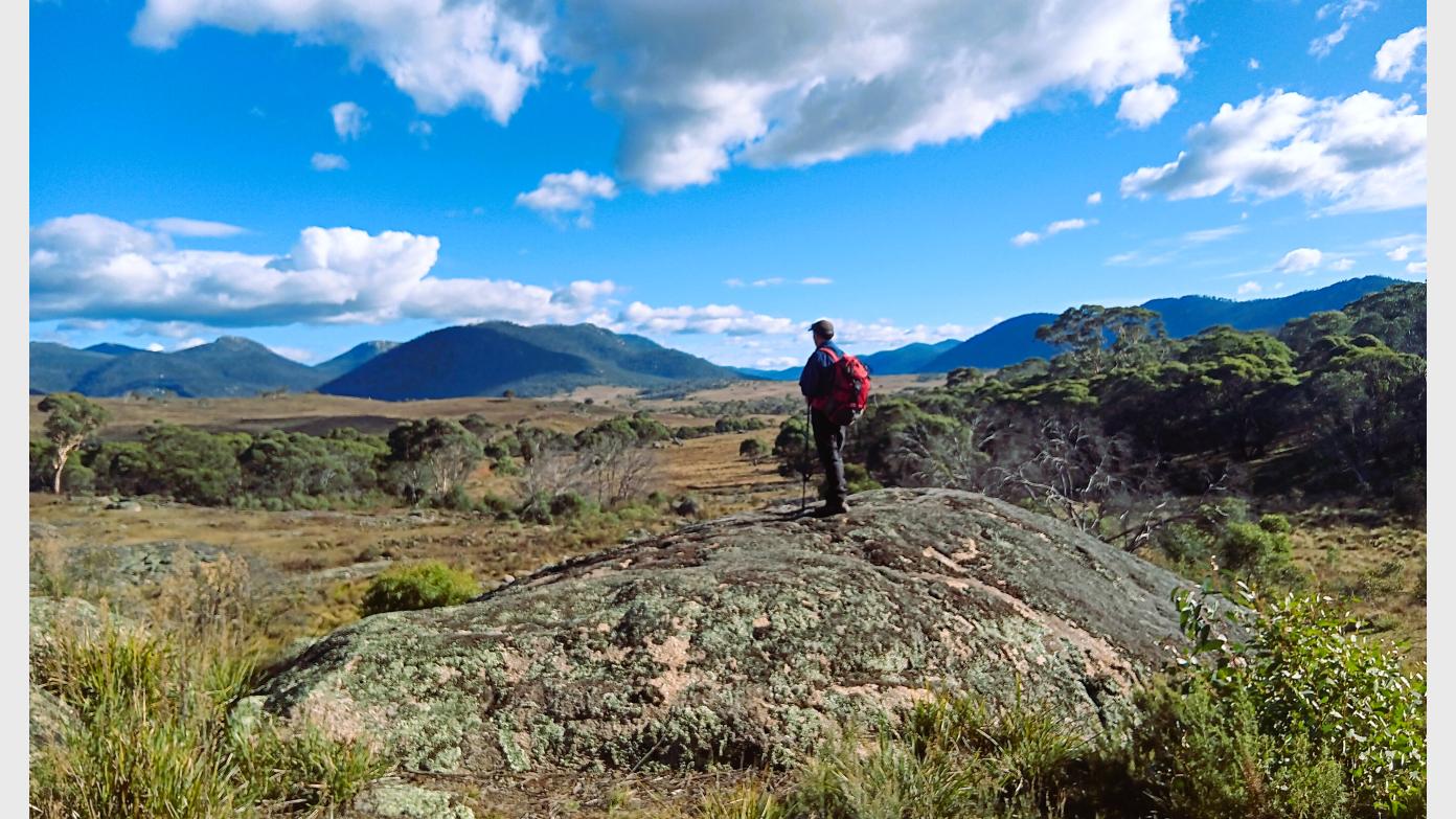
This hike begins near the Gudgenby Cottage. We head NE along a spur before making our way south along various spurs and gullies to a rock platform above Little Dry Creek. We cross Hospital creek and head SW on and off trail exploring the landscape until we arrive at Frank and Jacks Hut for a break. From the hut we join the Bogong Creek Track to the north before veering off-trail again following the contours of Bogong Creek to meet the Yankee Hat Track. We leave the track soon after and head north across the open grass lands to Middle Creek where we cross then turn to the SE for our last leg to our starting point, crossing the Gudgenby River and Hospital Creek along the way. The walk involves varied terrain including fire trails and off trail walking in open grass lands, woodland forest with varying thickness of vegetation from light to moderate scrub and creek/river crossings. The landscape is generally undulating, rocky/grassy slopes that may be slippery and/or unstable under foot. Gaiters a must to protect legs and walking pole(s) might be useful. The linear distance of 15 km with an adjustment for elevation gain of 440m makes this equivalent to a 19.4km track hike. Given the nature of the terrain (surface, vegetation, steepness) and the length/elevation gain/loss the hike is likely to take approximately 5.5hrs to complete and best suited for walkers with a moderate level of fitness, are comfortable off track and in the past month completed successfully at least one hike of 13-14km distance. Nature Connection: This walk intentionally balances social interaction with brief, guided periods of quiet, attentive walking and a short 'sit spot.' These moments are designed to support a deeper engagement with the landscape. Conversation is warmly welcomed at all other times.
Additional Information
Booking deadline
Thu 12th Mar 2026 05:00pm
Length
Medium
Terrain
Medium
Conditions
Partly Exploratory
Distance (km or hrs)
15
Ascent
440
Descent
440
Map name
8626-1S Rendezvous Creek 8626-2N Yaouk
Terrain information
Fire trails, open grass lands, woodland forest with varying thickness of vegetation from light to moderate scrub and creek/river crossings. Undulating with some steep sections and rocky/grassy slopes that are slippery and/or unstable under foot.
Transport information
Participants to make their own way to meeting point. Meeting place to be advised. Transport cost will be approximately $8-$10 per person
A walk or similar activity with a duration of a day or part day. No overnight gear required.
Date and Time
Activity Owner
SalihOzgul
Salih Ozgul