Croajingalong NP: Victorian Wilderness Coast Walk - South to North
Tue 19th May 2026
(This trip was rescheduled from 2025)
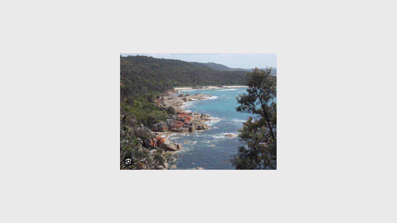
This is a walk between Bemm River and Mallacoota taking in a wilderness section of the Victorian coastline including Point Hicks, Petrel Point, Wingin Inlet and Shipwreck Creek. We'll be walking along rocky points, long sections of beaches and up on tracks through heathland. We'll drive down from Canberra to Mallacoota and then use a local transport service to drop off the group to the start of the walk and our first night's camp at Clinton Rocks. From there we can do an explore west towards Tamboon Inlet. After that, each day's walk will be between 10 and 14km. On the final day there is the option of walking right into Mallacoota (checking out Bastion Point) or bailing out earlier at Betka River. The full walk from Clintons Rock to Mallacoota is around 95km with just over 1000m cumulative climbing (inc. side trips). We'll be taking one or two packrafts to enable crossing and exploration of key rivers so participants will be expected to take some group gear. At this time of year, we expect stable autumn weather and lots of whales migrating north (according to the lighthouse keeper at Gabo Island)! There might be ticks requiring tick prevention and treatment measures. Extra water might need to be carried between camps as it may be difficult to find free flowing creeks. While we're allowing 7 days and 6 nights for the activity including travel to/from Canberra, we may finish earlier. The day-to-day itinerary, including the beach camps will be advised in the message board. The transport service will cost around $350 for the group but this will be confirmed closer to the start date. Other costs are Victoria Parks camping fees and car pooling costs to/from Canberra - tba via message board. Given the fuel crisis, and escalating transport costs, car pooling will be arranged.
Additional Information
Booking deadline
Thu 01st Jan 2026
Length
Medium
Terrain
Medium
Conditions
Exploratory
Distance (km or hrs)
up to 100km
Ascent
up to 1000m cumulative; biggest climb is 290m on the last day.
Map name
Mallacoota 1: 50K; Everard North 1:25K; Tamboon North 1:25K; Bemm North 1:25K among others.
Terrain information
Beaches, rocky points, heath, tracks.
Transport information
Transport service from Mallacoota to Clintons Rock is $350 but this may change due to the fuel crisis. Carpooled transport to/from Mallacoota tbc via messag board.
Travelling date
Tue 19th May 2026
Accommodation information
Remote and official beach camp tbc by message board.
A multi day backpacking or base-camping activity.
Date and Time
Activity Owner
MonikaBee
Monika Binder