Smartphone Nav on Red Hill
Sun 17th Aug 2025
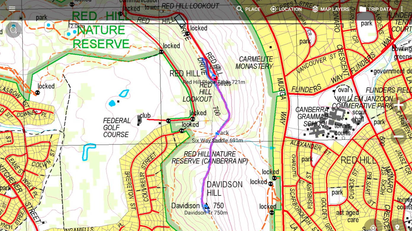
Join us for an outdoor Smartphone Navigation Tutorial, on Red Hill, on Sunday the 17th of August. Expect to be out and about for about three hours. dress warmly for bushwalking and bring your lunch. We will gather near the Lunetta Cafe at about 10.30AM. Bring your smartphone, your bushwalking nav app, and any other nav gadgets you would like to cross compare. We will start our smartphone apps, then toddle towards Davidson Trig 750m. Expect slow going, much finger poking, many stops, and much chatter. We can load apps and maps to your phone on the run. Tutorials will continue until September.
Important information re smartphone nav can be found on the www site of Smartnav UK, read Myth Busting at https://smartnav.uk/?page_id=1894, also read https://smartnav.uk/?page_id=316. Then read on through this site.
For Android smartphone apps I recommend - Backcountry Navigator PRO TOPO GPS. See: https://docs.google.com/document/d/1Nmk9oqnotQ9R2alcjR1N4LL6T51UoW0YO_IKsWzjeEc/edit?pli=1#heading=h.nd96wbwhphgh, also Cartograph Maps at https://www.cartograph.eu/v3/help/, and Handy GPS at https://www.binaryearth.net/HandyGPS/.
For iPhone smartphone apps I recommend- Backcountry Navigator XE See: https://www.manula.com/manuals/crittermap/backcountry-navigator-xe/1/en/topic/using-the-app, also Cartograph Maps at https://www.cartograph.eu/v3/help/, and Handy GPS at https://www.binaryearth.net/HandyGPS/.
I suggest you do not use All Trails or Strava apps for bushwalking, these are for use within reach of phone towers.
When bushwalking your phone should be in Airplane Mode, this greatly extends battery life.
Learn to use Screen Pinning for Android or Guided Access for iPhone, this also extends battery life.
For local maps I recommend - SIX-NSW, LIST, Maps VIC, Q Topo, LINZ, Open Android, and Worldwide Imagery through Arc GIS.
Bring any other devices, apps or maps you would like to compare, and perhaps bring a notepad and pencil.
Additional Information
Booking deadline
Sat 16th Aug 2025 08:00pm
Length
Short
Terrain
Medium
Distance (km or hrs)
4km
Ascent
150m
Descent
150m
Map name
https://www.gpsvisualizer.com/draw/?bg=AU_NSW_SIX_TOPO&z=15&c=-35.331967,149.118547&marker=
Terrain information
On CNP walking track, fairly rocky and rough. occasional off track. Bring, a day pack, your lunch, walking shoes, a parka, and bring your smartphone and any nav apps you have already installed.
Transport information
Personal cars, e-bikes, bikes (grunt) to the top of Red Hill
A walk or similar activity with a duration of a day or part day. No overnight gear required.
Date and Time
Activity Owner