
Le Tour de Hût - Thredbo to Tharwa on the AAWT
Sun 07th Dec 2025
(Full. Waitlist started.)
A twelve (and-a-bit) day, 225km hike along the northern third of the Australian Alps Walking Track; Covering this much ground will take us through a variety of environs, from the windswept Main Range to the grassy hills around Kiandra, to the caves and canyons of Blue Waterholes and the forests of Namadgi.
We will need drivers to drop us at Dead Horse Gap near Thredbo.
Food drops will be placed at Kiandra prior to hike.
Two spare days allow a delayed start in case of weather.
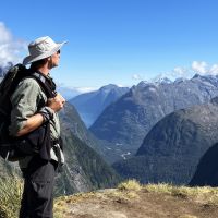
Participants will need experience of multi-day pack hikes and a good understanding of what sort of distances and elevations they are capable of walking day after day. While I’ve tried to keep the daily distances to a manageable level, the compound effect of walking with a pack for twelve days is not to be underestimated. Once begun, there aren’t a lot of opportunities to get off the track. Occasional fantastic views guaranteed. Preference will be given to those I’ve walked with and whose capacity I’m familiar with.
Day 1: Dead Horse Gap > campsite east of The Sentinel: 17km, +1100m -600m
Day 2: over Rolling Grounds to Whites River Hut: 18km, +600m -900m
Day 3: to Upper Geehi via Mt Gungartan: 17km, +600m -500m (alt: Tumut River via fire trail)
Day 4: to Mackays Hut via Mt Jagungal summit: 17km, +700m -900m
Day 5: to Happy’s Hut: 22km +600m -600m
(alt: via Boobee hut)
Day 6: to Four Mile Hut via Tabletop & Broken Dam Hut: 17km +400m -400m
Day 7: to Witzes Hut via Kiandra food drop: 20km +500m -600m
Day 8: to Hainsworth Hut via ford of Murrumbidgee: 23km +600m -600m
Day 9: to Blue Waterholes via Bill Jones Hut: 18km +300m -500m
Day 10: to Murrays Gap: 16km, +700m -300m (optional Mt Bimberi summit)
Day 11: to Orroral Valley: 21km, +600m -1200m
Day 12: to Bushfold Flats: 18km, +700m -700m
Day 13: to Namadgi Visitor Centre: 6km, +200m -700m
Additional Information
Booking deadline
Thu 06th Nov 2025
Length
Extra Long
Terrain
Medium
Conditions
Partly Exploratory Wet
Distance (km or hrs)
18km/day average. Some days as much as 22km.
Ascent
600m/day average. Please see daily totals.
Map name
Australian Alps Walking Track - John Chapman
Terrain information
A macaroni necklace of fire trails, walking tracks, faint footpads and the occasional bit of off-track walking through open country. There are a number of river crossings to negotiate and some can be thigh deep at normal levels. Cold nights, hot days, rain and even snow are all possibilities though none are certain. A light pack weight is required to promote group safety and mobility, and to enable carrying six days of food.
Transport information
We will source two drivers to drop us at Dead Horse Gap. I will collect food drops from hikers and take them to Kiandra in the days prior to starting the walk (saves a delayed start by having one car divert to Kiandra along the way) $180 per car. 3 hikers per car Food drops and empty container retrieval =$100 Campsite bookings: up to $24 each = About $100 per hiker.
Accommodation information
BYO tent.
A multi day backpacking or base-camping activity.
Date and Time
Activity Owner
Chris-Day
Chris Day