
Gorilla Rock, Booroomba Rocks, and assorted spot heights.
Fri 06th Sep 2024
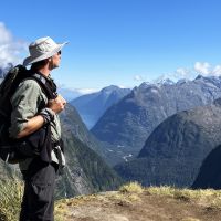
If like me, you missed out when Dick Morton recently put this walk on, here's your chance. From Honeysuckle Creek campsite we follow the AAWT north before going bush in search of Gorilla Rock. From there it's more bush eastwards towards SH1396, with a detour to "Booroomba’s Beautiful Butt" if time permits, with views of Booroomba Rocks buttresses and across Blue Gum Creek to Blue Gum Hill. From SH1396 we continue to Booroomba Rocks and SH1353 with good views expected. Then it's track and trail to Booroomba Rocks carpark and back along the AAWT to the start.
With the exception of the AAWT, I haven't been to any of these areas before, so this is "exploratory" for me. I'm expecting mild to moderate scrub. According to the last group, approaching Booroomba Rocks there's a bit of rock scrambling and slab walking involved to get onto some of the granite slabs. Participants need to be comfortable doing that, especially if there's moisture on the rocks.
About 12km in 5-6 hours.
Participants should bring morning tea and lunch, perhaps a hot drink. Warm layers, gaiters and gloves (if you use them). Rain gear is recommended on all walks.
Additional Information
Booking deadline
Thu 22nd Aug 2024 09:00pm
Length
Medium
Terrain
Rough
Conditions
Partly Exploratory
Distance (km or hrs)
12km
Ascent
600m
Descent
600m
Map name
Corin Dam
Terrain information
Some trails. Some scrub. Hopefully not too bad. Potentially some rock scrambling, but nothing too challenging. GPX: https://user.fm/files/v2-7d9542eaa8d02fb196ac4ea39b11a96d/booroomba-gorilla.gpx
Transport information
Meet at Lanyon Marketplace. $24 per car = $6 pp if there are 8 of us.
A walk or similar activity with a duration of a day or part day. No overnight gear required.
Date and Time
Activity Owner
Chris-Day
Chris Day