
Cuumbeun Nature Reserve Southern Section
Sat 17th Aug 2024
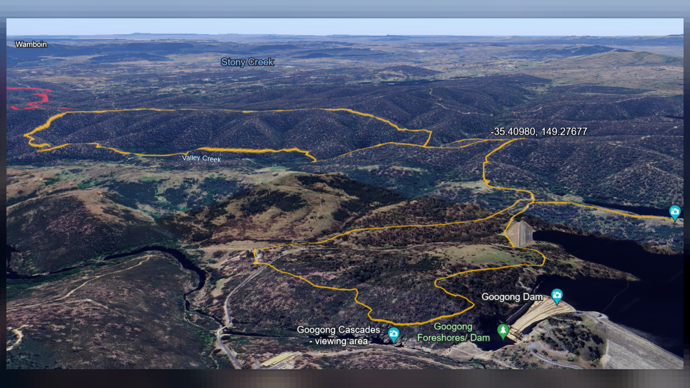
This walk is for club members only. The primary aim of this walk is to complete the mapping out of a loop route in the southern section of the Cuumbean Nature Reserve. We follow the Black Wallaby Loop Track until we meet up with the Bradleys Creek Walk. We head NE along Bradleys Creek Walk for a brief while with a side trip to take in the Googong Lookout before heading off-trail to enter the Cuumbean NR proper. We descend a spur to the NW to Valley Creek and then follow the contours of Valley Creek crossing varies gullies and creeks and ascending and descending a number of spurs and knolls before a very steep climb to join the Queanbeyan River Trail. We have a brief respite from off-trail walking as we follow this trail to the South East prior to descending towards Valley Creek via various ridges, spurs and gullies. One last steep ascent to the SW, a ridge line and descend to the W to connect once again to Bradleys Creek Walk for our return to our start. The walk will be predominately off-trail, criss-crossing the undulating landscape with some steep to very steep sections and rocky/grassy slopes and creek lines that are slippery and/or unstable under foot with varying thickness of vegetation from open woody grasslands to moderately thick scrub. Walking pole(s) and gloves might be useful at times and gaiters and/or long pants a must to protect legs. The linear distance of 13km with an elevation gain of 590m makes this equivalent to an 18.9 km hike and will take approximately 6 hrs to complete. Given the nature of the terrain (surface, vegetation, steepness) and the length/elevation gain/loss the hike is likely to be strenuous and best suited for walkers with a very good level of fitness, whom are confident off track and have hiked regularly during the past month and have completed successfully at least one club hike equivalent to a grading of medium/medium.
Additional Information
Booking deadline
Thu 15th Aug 2024 02:00pm
Length
Medium
Terrain
Rough
Conditions
Partly Exploratory
Distance (km or hrs)
approx. 13km
Ascent
approx. 590m
Descent
approx. 590m
Map name
8727-2S HOSKINSTOWN
Terrain information
Fire trails. Single trails. Footpads. Off-trail. Undulating landscape with some steep to very steep sections and rocky/grassy slopes and creeks that are slippery and/or unstable under foot with varying thickness of vegetation from open woody grasslands to moderately thick scrub.
Transport information
Participants to make their own way to the meeting point followed by a car pool to start of the hike. Meeting place and transport to be advised.
A walk or similar activity with a duration of a day or part day. No overnight gear required.
Date and Time
Activity Owner

SalihOzgul
Salih Ozgul